

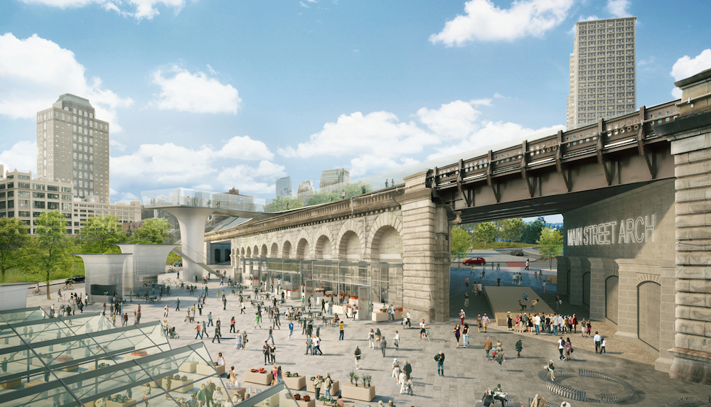
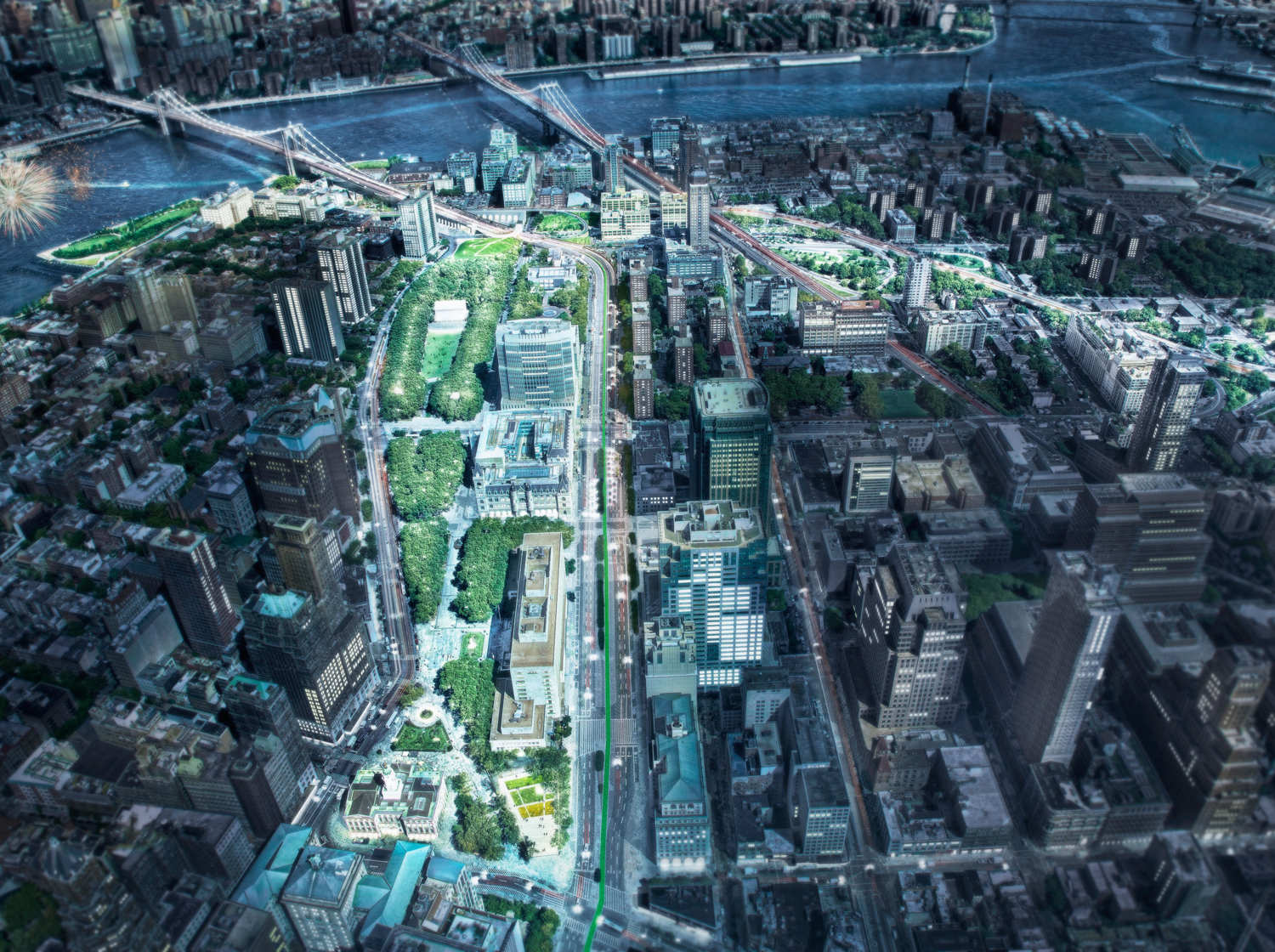
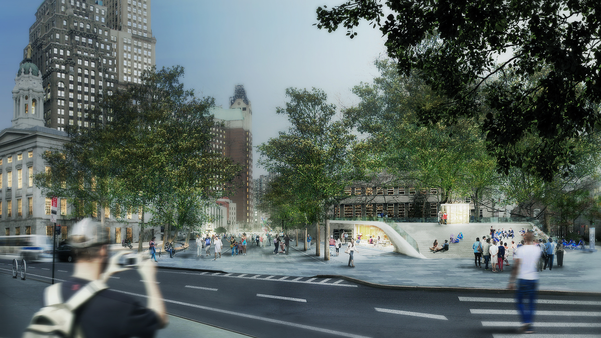
This week, WXY architecture + urban design revealed new designs for The Brooklyn Strand, a 50-acre public green space between Brooklyn Bridge and the borough’s downtown.
New renderings are now available because the two-year community input process has been completed. The process entailed scores of walkthroughs, meetings, and various public workshops. WXY got feedback from 250 community stakeholders, including residents, business leaders, community groups, municipal officials, and agencies.
"By design the Brooklyn Strand plan is an opportunity to adapt 1950s-era infrastructure into a new vision for true connectivity and accessibility between downtown Brooklyn, its neighborhoods and the waterfront," Claire Weisz, FAIA, architect and urbanist who co-founded WXY architecture + urban design, said in a statement. "The Brooklyn Strand plan transforms leftover spaces from expressway plans that cut off neighborhoods, turning them into into public spaces that connect people."
WXY’s Community Vision Plan will now be submitted for review by the city.
Renderings for the public-private project were originally revealed last November. It will connect Brooklyn's waterfront and Dumbo neighborhood to the courthouse in Downtown Brooklyn. Pedestrian paths and parks will be created, public art will be installed, a new market will be built in the the Brooklyn Bridge Anchorage, and the Brooklyn War Memorial will reopen.
The Brooklyn Strand will solve some safety issues, as pedestrians will no longer have to navigate through cars zipping around.
“All in all, the project, if realized, will almost seamlessly knit together neighborhoods that have been cut off by traffic,” Time Out New York’s Howard Halle writes. “It will still be a long walk from Borough Hall to the Bridge or DUMBO, but you won’t have to worry about getting hit, and there will be plenty of places to stop off along the way.”
Click images to enlarge.
Related Stories
The High Line | Feb 17, 2016
Patano Studio's proposed elevated park would bring new life, affordable housing to unpleasant Seattle highway
The park would cover a 45-acre swath of underutilized land over and along Interstate 5.


