


Later this month, construction is scheduled to begin on the country’s first business park specifically for unmanned aircraft.
The Associated Press reports that the first order of business for Grand Sky Development Corp., the park’s manager, will be building an eight-foot-high security chain link fence, with barbed wire at the top, to surround 200 acres adjacent to the Grand Forks Air Force Base in North Dakota.
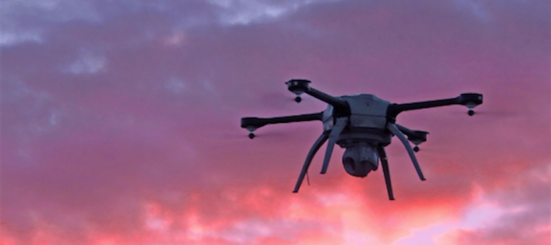
Last week, the 1.2-million-sf Grand Sky aerospace technology park—one of six sites designated by the Federal Aviation Administration for drone testing—was awarded $5.6 million from the state. North Dakota has already invested more than $30 million at this park, which recently added Northrup Grumman as its second anchor tenant, along with General Atomics. North Dakota’s legislature has appropriated $4.4 million for Grand Sky’s future development.
The contract for constructing the fence, which had been planned since 2011, was awarded to Grand Forks-based iconHD, whose parent company is ICON Architectural Group.
Thomas Swoyer, Jr., Grand Sky Development’s president, says the fence is “symbolic,” in that it will “define the park space and give us the ability to control our own access to it.”
General Atomics has signed a tentative agreement to establish an unmanned aerial systems training academy at the park.
In the summer of 2014, FAA announced the selection of the six public entities that would develop unmanned aircraft systems (UAS) research at test sites around the country. One of these is the North Dakota Department of Commerce, which was issued a Certificate of Waiver or Authorization (COA) to begin using a Draganflyer X4ES small UAS at its Northern Plains Unmanned Aircraft Systems Test Site.
Other drone test-site operators include:
• The University of Alaska, which was issued a COA that authorized flights by an Aeryon Scout small UAS for animal surveys at the university’s Pan-Pacific UAS Test Range Complex in Fairbanks. That authorization encompasses test ranges in Hawaii, Oregon, Kansas, and Tennessee.
• The State of Nevada, which was authorized to test an onsite ScanEagle drone at the Desert Rock Airport located in Mercury, Nev. Desert Rock Airport is a private airport owned and operated by the Department of Energy. The ScanEagle flies at or below 3,000 feet.
• Texas A&M University–Corpus Christi plans to develop safety requirement for UAS vehicles. It is authorized to use an AAAI RS-16 UAS, which weights about 85 pounds and has a wingspan of almost 13 feet.
• Griffiss International Airport is authorized to test at a site in Rome, N.Y. One drone is a PrecisionHawk Lancaster Platform UAS that weighs about three pounds and has a wingspan of four feet. Texas-based HoverStat, which develops technology to use small drones for measuring roofs for solar panel installation, reportedly decided to choose Syracuse as a testing location because the Rome site was nearby.
• Virginia Polytechnic Institute is conducting failure mode testing with a Smart Road Flyer, a low cost, low risk multi-rotor UAS being developed to support research in vehicle and highway systems. Other UAS models being tested include an eSPAARO, Aeryon Sky Ranger, MANTRA2, Sig Rascal, and two AVID EDF-8 micro UASs.
At this site, the Mid-Atlantic Aviation Partnership—a part of Greene’s Institute—has spearheaded drone research. The Virginia Tech site is partnered with the University of Maryland and Rutgers University in New Jersey.
Last month, the Federal Aviation Administration waived the authorization process for the agency’s six nationwide drone test sites that had required clearance before moving forward with research exercises at or below 200 feet.
Related Stories

AEC Tech | May 9, 2016
Is the nation’s grand tech boom really an innovation funk?
Despite popular belief, the country is not in a great age of technological and digital innovation, at least when compared to the last great innovation era (1870-1970).

Big Data | May 5, 2016
Demand for data integration technologies for buildings is expected to soar over the next decade
A Navigant Research report takes a deeper dive to examine where demand will be strongest by region and building type.

BIM and Information Technology | May 2, 2016
How HDR used computational design tools to create Omaha's UNO Baxter Arena
Three years after writing a white paper about designing an arena for the University of Nebraska Omaha, HDR's Matt Goldsberry says it's time to cherry-pick the best problem-solving workflows.
Drones | Apr 25, 2016
The Tremco SkyBEAM UAV is the first to be approved by the FAA for nighttime commercial operation
The SkyBEAM UAV is used for identifying energy leaks, rooftop damage, deteriorating façades, and safety issues without requiring scaffolding or cranes.

BIM and Information Technology | Apr 21, 2016
U.K. imposes BIM requirement on government projects
U.S. unlikely to follow suit.

AEC Tech | Apr 15, 2016
Should architects learn to code?
Even if learning to code does not personally interest you, the growing demand for having these capabilities in an architectural business cannot be overlooked, writes computational design expert Nathan Miller.

Building Tech | Apr 12, 2016
Should we be worried about a tech slowdown?
Is the U.S. in an innovative funk, or is this just the calm before the storm?

BIM and Information Technology | Apr 8, 2016
Turner streamlines construction progress tracking using predictive visual data analytics
The construction giant teams with a computer science and engineering professor to develop a clever drone- and rover-based construction monitoring tool.

BIM and Information Technology | Apr 5, 2016
Interactive 3D map shows present and future Miami skyline
The Downtown Miami Interactive 3-D Skyline Map lets users see the status of every downtown office, retail, residential, and hotel project.

AEC Tech | Mar 31, 2016
Deep Learning + AI: How machines are becoming master problem solvers
Besides revolutionary changes to the world’s workforce, artificial intelligence could have a profound impact on the built environment and the AEC industry.


