

DPR Construction tries to resist being driven by the technology of the moment, says Chris Torres, the firm’s Technology Integration Manager.
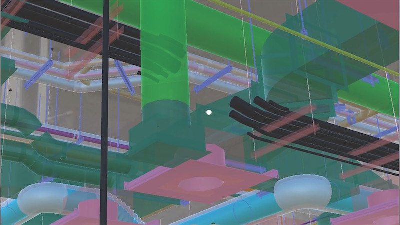
But there are times, he admits, when attention must be paid. That happened last November, when Torres got his first glimpse of Indoor Reality, a backpack with a built-in laser scanner that its creators claim can scan 200,000 sf in just eight hours—roughly 30 times faster than stationary scanners.
The product—one of several similar backpacks on the market—goes wherever the user roams, using cellphone-based indoor GPS as its guide. The manufacturer claims the unit can help project teams generate Revit models three times faster than traditional point cloud methods.
Indoor Reality’s $100,000 price tag might be prohibitive for some AEC firms, but Torres says the supplier also showed a hand-held version that goes for around $15,000.
The reality capture world is replete with new products; so many, in fact, that it’s a wonder buyers can keep up with the releases. Here are a few new products and platforms that caught our eye:
- RTK and PPK. These are acronyms for real-time kinematic and post-processing kinematic GPS sensors. They are part of systems that provide accurate camera locations when using drones for mapping. They reduce the need for surveyed ground control to produce accurate digital terrain models and orthophotos from photogrammetry. PPK doesn’t require a radio link. Accuracies of 25 mm (XY coordinate) and 50 mm (Z coordinate) are achievable.
- A host of hand-held laser scanners has been making its way onto the market. One that’s been getting attention from AEC experts is Leico Geosystems’ BLK 360 scanner. Size: 6.5 inches by 4 inches. Weight: 2.2 pounds. It is capable of 360-degree spherical imaging, thermal imaging, and full 360-degree reality capture in less than three minutes. Price: under $16,000.
- SLAM, which stands for simultaneous localization and mapping, lets construction workers walk through a project site and map it in extreme detail in minutes. SLAM scans in real time and doesn’t require GPS. One company in this arena, GeoSLAM, recently launched Desktop V3, which incorporates a 2D and 3D viewer so registered point clouds can be viewed without moving to third-party software.
- Product tie-ins are the rage these days. Enscape, which provides visualization software for architects, just released a real-time rendering plug-in for Revit. Early adopters include Kohn Pedersen Fox and Foster+Partners. “What’s important,” says Thomas Schander, Enscape’s CEO, “is that now you don’t need to be a rendering expert to create stunning presentations.”
Related Stories

Big Data | May 5, 2016
Demand for data integration technologies for buildings is expected to soar over the next decade
A Navigant Research report takes a deeper dive to examine where demand will be strongest by region and building type.

BIM and Information Technology | May 2, 2016
How HDR used computational design tools to create Omaha's UNO Baxter Arena
Three years after writing a white paper about designing an arena for the University of Nebraska Omaha, HDR's Matt Goldsberry says it's time to cherry-pick the best problem-solving workflows.

Drones | Apr 25, 2016
The Tremco SkyBEAM UAV is the first to be approved by the FAA for nighttime commercial operation
The SkyBEAM UAV is used for identifying energy leaks, rooftop damage, deteriorating façades, and safety issues without requiring scaffolding or cranes.

BIM and Information Technology | Apr 21, 2016
U.K. imposes BIM requirement on government projects
U.S. unlikely to follow suit.

AEC Tech | Apr 15, 2016
Should architects learn to code?
Even if learning to code does not personally interest you, the growing demand for having these capabilities in an architectural business cannot be overlooked, writes computational design expert Nathan Miller.

Building Tech | Apr 12, 2016
Should we be worried about a tech slowdown?
Is the U.S. in an innovative funk, or is this just the calm before the storm?

BIM and Information Technology | Apr 8, 2016
Turner streamlines construction progress tracking using predictive visual data analytics
The construction giant teams with a computer science and engineering professor to develop a clever drone- and rover-based construction monitoring tool.

BIM and Information Technology | Apr 5, 2016
Interactive 3D map shows present and future Miami skyline
The Downtown Miami Interactive 3-D Skyline Map lets users see the status of every downtown office, retail, residential, and hotel project.

AEC Tech | Mar 31, 2016
Deep Learning + AI: How machines are becoming master problem solvers
Besides revolutionary changes to the world’s workforce, artificial intelligence could have a profound impact on the built environment and the AEC industry.

Big Data | Mar 28, 2016
Predictive analytics: How design firms can benefit from using data to find patterns, trends, and relationships
Branden Collingsworth, HDR’s new Director of Predictive Analytics, clarifies what his team does and how architecture projects can benefit from predictive analytics.


