

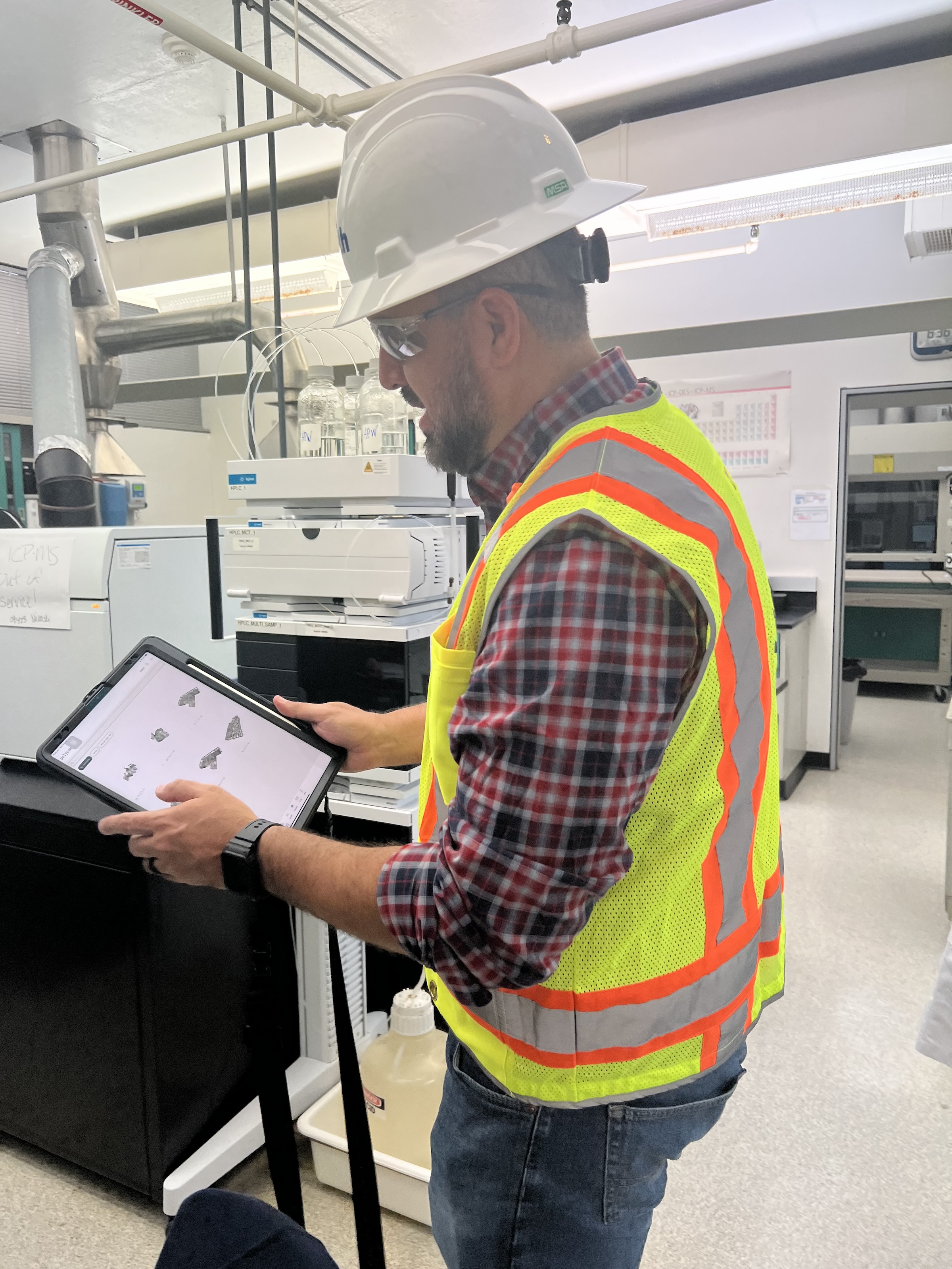
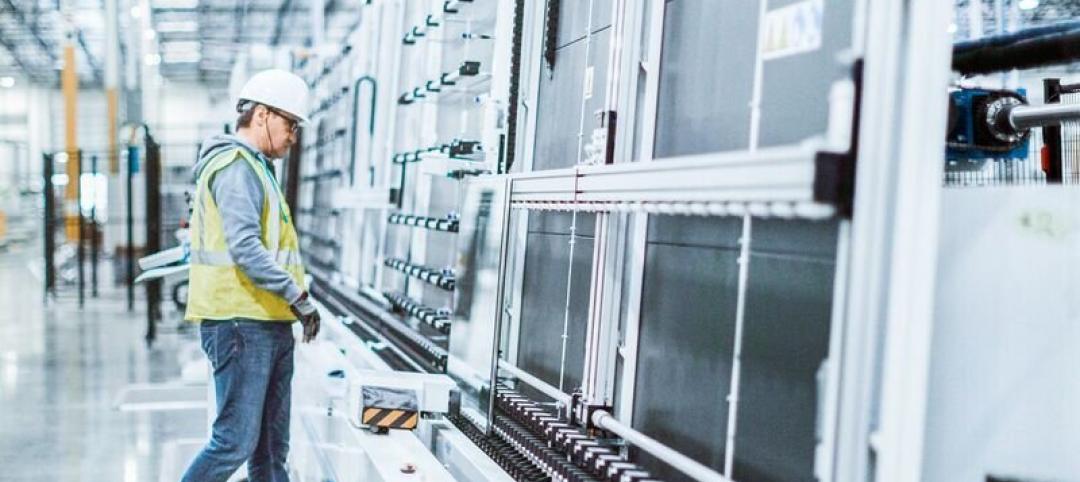
 in Virginia Beach, Va., used LIDAR and BIM technology to develop precise building and equipment data for a planned expansion of its Central Environmental Laboratory. Photo courtesy CDM Smith")
In the world of architecture and engineering, laboratory buildings are among the most complex buildings to design, plan, and document. Traditional methods rely on the use of photographs, hand drawings, or notes to document not only the building but also the equipment that makes up a laboratory. This makes the process difficult, tedious, time consuming, and even allows for documentation errors.
Currently, the most advanced state-of-the-art technology is combining Light Detection and Ranging (LIDAR) technology with Building Information Modeling (BIM) technology. LIDAR is a remote sensing method that uses light in the form of a pulsed laser to measure ranges to Earth. BIM is workflow process software used to model and optimize projects.
The latest LIDAR technology is available in the current version of hand-held devices that are used for field documentation. These devices come equipped with a very reliable LIDAR scanner, which allows one to easily document and scan in a point cloud all the existing conditions of the building like its space, function, and mechanical, electrical, and plumbing (MEP) needs.
Following the LIDAR scan, advanced software is deployed to transfer the data into a point cloud. This serves as a reliable reference to take measurements, to know where equipment is, and what its MEP needs are. Once in the point cloud, it is then exported into Autodesk ReCap Pro, and later to Autodesk Revit, which are BIM solutions.
Here it is not only inserted into the point cloud to corroborate measurements, locations and needs. It is also with the use of BIM technology and the use of special equipment families, that the foundations for the use of 7D Management of the laboratory equipment and MEP items can be developed into a 7D BIM Model.
A digital twin, which is a digital representation of a physical object or process in a digital version of its environment, can also be developed from this point. Digital twins can help an organization simulate real situations and their outcomes, ultimately allowing it to make better decisions.
LIDAR and BIM technology for building data collection
LIDAR and BIM technology such as Revit allows the existing conditions captured on site to be preserved in the digital model, allowing for measurements, orientation to aspects of the model, etc. without having to be physically on site, and more importantly, to have an orientation as to where each piece of equipment is and what the MEP needs are.
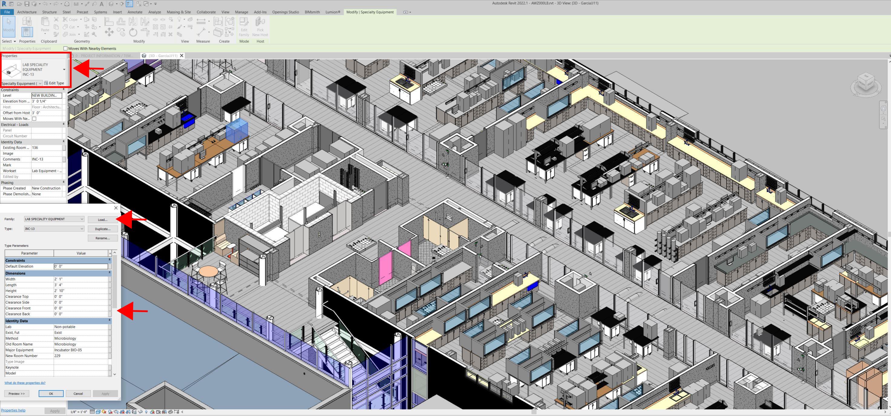
Even for any highly experienced architect or BIM modeler, just using photographs or hand drawings can be overwhelming and very complicated. Using this process, the Revit model serves as a replica of the existing conditions of each space and equipment. During a building expansion, being able to compare existing equipment in the new space is more accurate and easier to understand.
For example, Hampton Roads Sanitation District (HRSD) in Virginia Beach, Va., used LIDAR and BIM technology to develop precise building and equipment data for a planned expansion of its Central Environmental Laboratory.
The process involved meticulously scanning each space relevant to the project. This comprehensive scan aimed to capture every corner accurately. Following the scanning phase, the data was processed, generating a point cloud in ReCap Pro format. With the point cloud, we harnessed the advantages of LIDAR technology such as digitally acquiring existing conditions of the building and equipment, essentially providing a virtual on-site experience with just a click, eliminating the need for physical site visits.
This technology has enabled us to create detailed digital 3D families for every existing piece of equipment and its needs, as well as to capture more accurate existing conditions for the building. In the past, our approach relied solely on on-site measurements and photographs, leading to continuous errors and laborious, time-consuming tasks.
The previous method also necessitated numerous site visits for data verification. The implementation of this advanced technology and streamlined process has not only saved time and money but has also significantly enhanced our efficiency. For instance, all of that work required in the past to digitally model from notes, photographs, existing building plans, etc. has been condensed to the import and refinement of the point cloud data into the modeling environment.
Related Stories

AEC Tech | Mar 4, 2021
The Weekly show, March 4, 2021: Bringing AI to the masses, and Central Station Memphis hotel
This week on The Weekly show, BD+C editors speak with AEC industry leaders about the award-winning Central Station Memphis hotel reconstruction project, and how Autodesk aims to bring generative design and AI tools to the AEC masses.

AEC Tech | Jan 28, 2021
The Weekly show, Jan 28, 2021: Generative design tools for feasibility studies, and landscape design trends in the built environment
This week on The Weekly show, BD+C editors speak with AEC industry leaders from Studio-MLA and TestFit about landscape design trends in the built environment, and how AEC teams and real estate developers can improve real estate feasibility studies with real-time generative design.
AEC Tech | Dec 21, 2020
GIS benefits are widely accepted, but measurements of importance vary among AEC firms
Future usage might boil down to competitive pressure, according to a Dodge Data & Analytics survey.

AEC Tech | Dec 17, 2020
The Weekly show: The future of eSports facilities, meet the National Institute for AI in Construction
The December 17 episode of BD+C's The Weekly is available for viewing on demand.
AEC Tech | Dec 15, 2020
DLR Group launches intelligent air quality analytics platform
sonrai IAQ™ by DLR Group delivers actionable intelligence to optimize facility operations and enhance occupant comfort.
AEC Tech | Dec 8, 2020
COVID-19 affects the industry’s adoption of ConTech in different ways
A new JLL report assesses which tech options got a pandemic “boost.”

Contractors | Dec 4, 2020
‘Speed to market’ defines general contractor activities in 2020
Contractors are more receptive than ever to ways that help get projects done faster.

Smart Buildings | Nov 20, 2020
The Weekly show: SPIRE smart building rating system, and pickleball court design tips
The November 19 episode of BD+C's The Weekly is available for viewing on demand.

AEC Tech | Nov 12, 2020
The Weekly show: Nvidia's Omniverse, AI for construction scheduling, COVID-19 signage
BD+C editors speak with experts from ALICE Technologies, Build Group, Hastings Architecture, Nvidia, and Woods Bagot on the November 12 episode of "The Weekly." The episode is available for viewing on demand.

AEC Tech | Oct 28, 2020
Meet Jaibot, Hilti's new construction robot
The semi-autonomous robot is designed to assist MEP contractors with ceiling-drilling applications.


