

The terms “desire path” and “line of desire” bring with them a bit of a mystical feeling, as if they were something Indiana Jones would need to find a way to cross to get to the Ark of the Covenant or the Holy Grail that awaits on the other side. In reality, desire paths are not quite so fantastical.
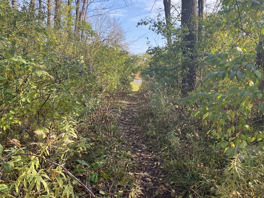
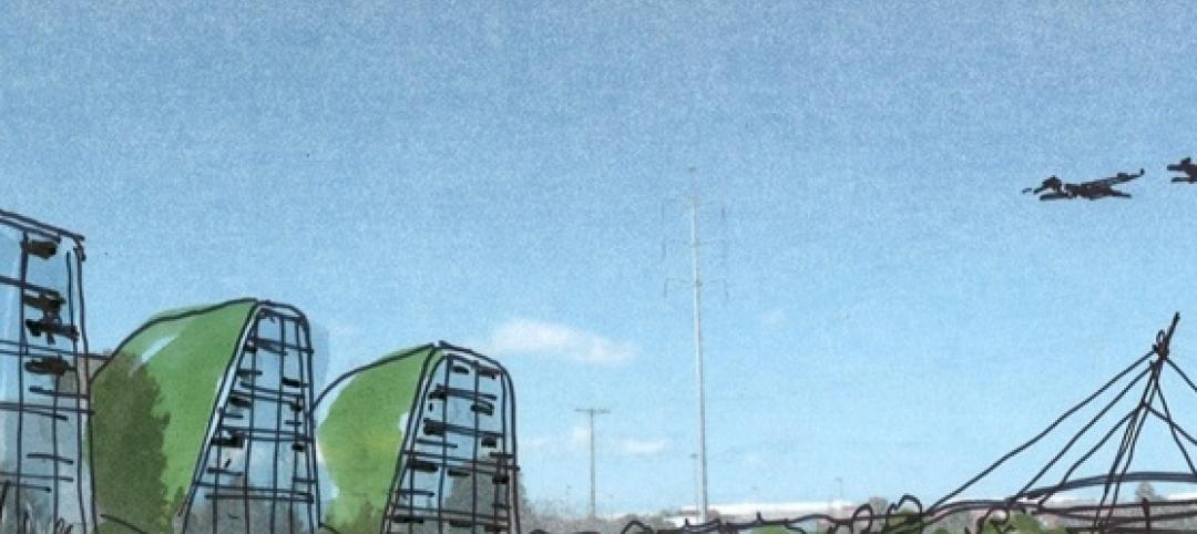
Even if you have never heard the term desire path, odds are you’ve seen one at some point. If you’ve ever been walking around a college campus, public park, or downtown area, you have probably seen an informal dirt path that cuts a corner, or through a field, or even through a few small shrubs or bushes. This path isn’t paved and clearly wasn’t part of the original plan, but thanks to the desire of many to find the path of least resistance from point A to point B, it has emerged over the years from repeated use.
Desire paths don’t necessarily have to be so rustic, either. Lines of desire can also be represented by people using formalized roads or paths in ways they were not intended to be used, such as a service road that has become a main pedestrian thoroughfare.
In general, a desire path or line of desire represents any path that end users have determined to be the most efficient way to travel, regardless of its intended use.
“They reflect the natural tendency of where people want to move. These lines are predicated on there being barrier-free environments,” says Caitlyn Clauson, Principal, Chair at Large on Board of Directors, and Planner at Sasaki. “If areas are inaccessible, for example with a steep slope or a discontinuous sidewalk, individuals will find other routes. Desire lines are often informed by adjacent land uses, especially uses with active ground floor functions and high levels of transparency and shade that make spaces inviting and habitable.”
For many, especially planners and designers, a desire path is an unsightly reminder that a campus or downtown design plan was not as efficient and pedestrian-friendly as it could have, or perhaps should have, been. It proves just because something was designed to function a certain way, it doesn’t mean end users will necessarily follow suit.
There are two solutions to the scourge of the desire path: find a way to create a space so optimally designed desire paths won’t ever rear their ugly heads, or create a space so flexible that if a desire path does appear, it can be formalized and integrated into the design.
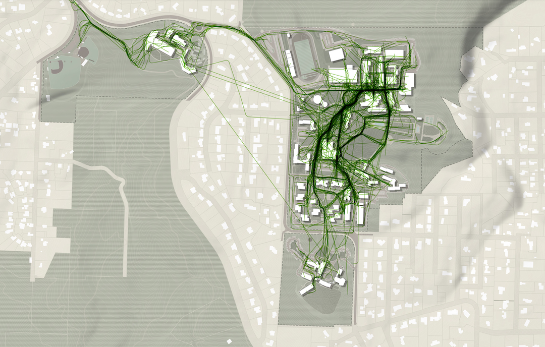
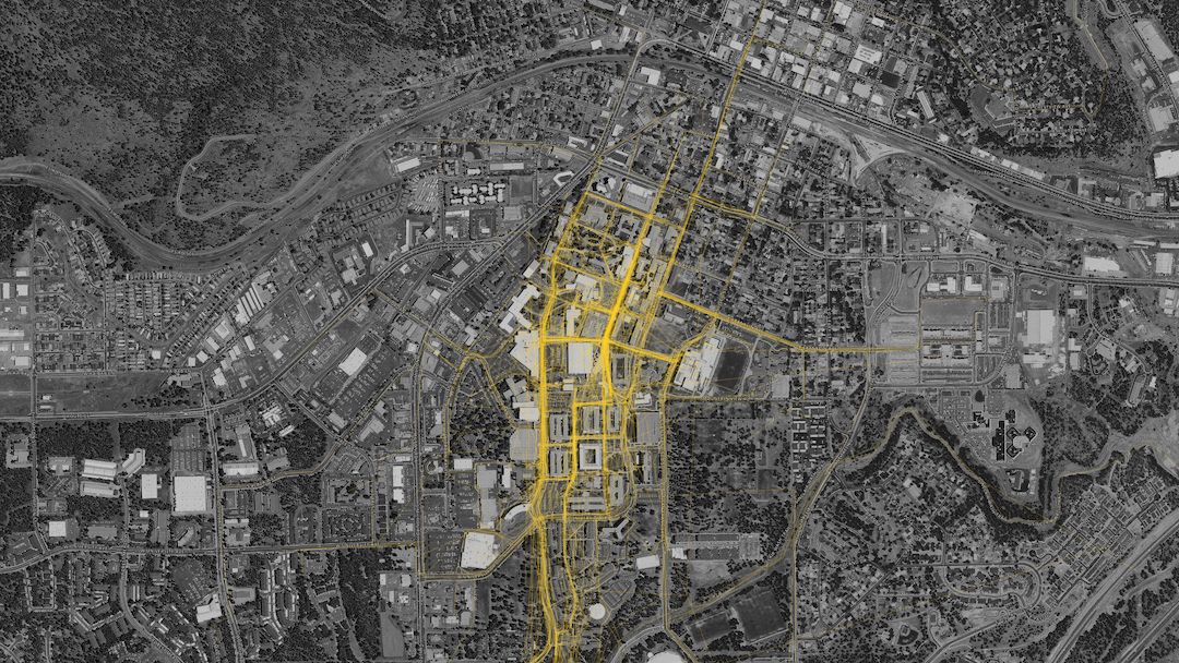
Sasaki’s CoMap helps spot ‘desire paths’ before they start
In order to prevent desire paths from taking shape, they need to be taken into consideration during a project’s earliest phases. “We did a feasibility study for UC San Diego in 2019 involving some developer land adjacent to campus and the campus architect was intrigued by my use of the term ‘line-of-desire’ in our initial meeting,” says Paul Schlapobersky, AIA, Associate Principal, Urban Designer, and Architect with Sasaki. “The entire study became about trying to ‘complete’ that line through a system of walkways and bridges connecting important nodes on the campus to this off-campus site and to newly-installed public transit beyond.”
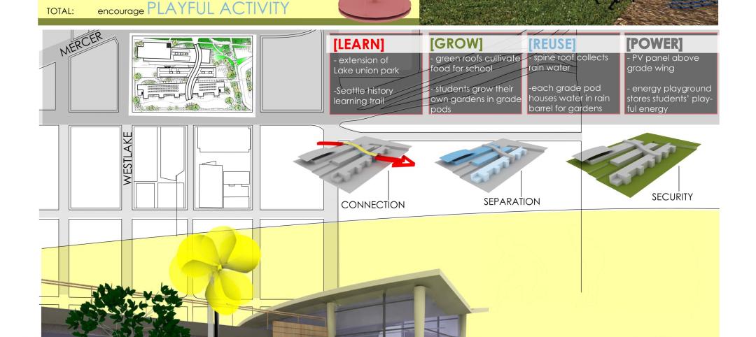
One of the main tools Sasaki uses to mitigate the informal desire path is a proprietary program developed by its in-house data and design tools group called CoMap. This collaborative mapping program generates a spatial visualization of how people experience a campus or region. When used at institutions, CoMap’s survey function allows campus communities to add notes about places or trace routes on a map of the campus. Sasaki then uses the data to inform planning recommendations.
“Many times the paths most traveled by students are not necessarily formally designed paths. The planning recommendation might therefore be to strengthen a desire line path by widening it, resurfacing it, removing an impediment, or lining it with active uses,” says Tyler Patrick, AICP, Principal, Chair of Planning and Urban Design on Board of Directors, and Planner with Sasaki. “For example, sometimes we find that service drives that are designed for vehicles are also heavily used by pedestrians, so we can instead redesign the path as more of a shared-use amenity, with aesthetic improvements to paving, lighting, etc.”
At one university, Sasaki used CoMap to learn that the formal entry to the campus was rarely used and the service drive actually served as the primary pedestrian route into campus. The design team took this information and reoriented the campus and created a new “front door” where the service drive used to be, with service access still accommodated, but in a more understated manner.
Sasaki also used CoMap in a master planning effort the firm led for Lewis & Clark College. The CoMap survey highlighted a strong north-south pedestrian route along an existing road. In response to the user feedback from CoMap, Sasaki turned the route into a primary pedestrian promenade on campus, surrounded by new residential and student life facilities.

CoMap is just one strategy the firm uses to create efficient plans without any informal desire paths. “We employ a range of strategies that include analyzing the existing system of pathways (what forms of mobility they support, their width, condition, amenities, etc.); collecting a variety of data (for instance, looking at where the concentration of classrooms is, as well as classroom utilization, to see key areas between which students may be moving); and conducting interviews and surveys to learn how pathways are used, deficiencies in the overall system, and desire paths that have not been formalized,” says Patrick.
Desire paths do not always equal good design
Just because an informal desire path appears, it does not mean it should always be formalized. Especially if the path is in direct conflict with the greater overall design scheme. “For instance, students may want to formally cross through a recreation field, but we want to maintain the field’s integrity for recreation and so we wouldn’t want to formalize that kind of desire path,” Patrick says.
Other instances may include environmental or safety concerns, such as wanting to keep a stream side riparian system intact as opposed to introducing formalized pedestrian pathways. “If a desire line promotes a path that isn’t accessible, we likely would not want to promote that movement,” adds Clauson.
The key is to balance how people want to use a given space without it turning into a free-for-all. Desire paths can, and often times do, suggest improvements for pedestrian circulation, but blindly formalizing any desire path can easily lead to a one step forward, two steps back situation. As Patrick said above, a desire path that cuts through a recreation field may prove that it is the most efficient way to traverse a campus, but formalizing it would certainly lead to more complaints about a now fractured field that is much more of an inconvenience than the lack of a formal path ever was.
As is often the case in modern design, the benefits of flexibility should never be understated. “A good campus plan should be flexible enough to accommodate evolving patterns of use and allow for the campus to integrate new ideas into the framework,” Patrick says.
The desire path, then, is representative of a larger point: There is no such thing as a perfect design, but there can be a perfectly adaptable one. Having the ability to continually adjust and formally adapt to the desires of end users is the best way to achieve the highest possible efficiency for any design.
Related Stories
| Apr 13, 2011
Office interaction was the critical element to Boston buildout
Margulies Perruzzi Architects, Boston, designed the new 11,460-sf offices for consultant Interaction Associates and its nonprofit sister organization, The Interaction Institute for Social Change, inside an old warehouse near Boston’s Seaport Center.
| Mar 10, 2011
How AEC Professionals Are Using Social Media
You like LinkedIn. You’re not too sure about blogs. For many AEC professionals, it’s still wait-and-see when it comes to social media.
| Mar 9, 2011
Hoping to win over a community, Facebook scraps its fortress architecture
Facebook is moving from its tony Palo Alto, Calif., locale to blue-collar Belle Haven, and the social network want to woo residents with community-oriented design.
| Mar 1, 2011
How to make rentals more attractive as the American dream evolves, adapts
Roger K. Lewis, architect and professor emeritus of architecture at the University of Maryland, writes in the Washington Post about the rising market demand for rental housing and how Building Teams can make these properties a desirable choice for consumer, not just an economically prudent and necessary one.
| Feb 23, 2011
Call for Entries: 2011 Building Team Awards, Deadline: March 25, 2011
The 14th Annual Building Team Awards recognizes newly built projects that exhibit architectural and construction excellence—and best exemplify the collaboration of the Building Team, including the owner, architect, engineer, and contractor.
| Feb 23, 2011
“School of Tomorrow” student design competition winners selected
The American Institute of Architecture Students (AIAS) and Kawneer Company, Inc. announced the winners of the “Schools of Tomorrow” student design competition. The Kawneer-sponsored competition, now in its fifth year, challenged students to learn about building materials, specifically architectural aluminum building products and systems in the design of a modern and creative school for students ranging from kindergarten to sixth grade. Ball State University’s Susan Butts was awarded first place and $2,500 for “Propel Elementary School.”
| Feb 22, 2011
LEED Volume Program celebrates its 500th certified Pilot Project
More than 500 building projects have certified through the LEED Volume Program since the pilot launched in 2006, according to the U.S. Green Building Council. The LEED Volume Program streamlines the certification process for high-volume property owners and managers, from commercial real estate firms, national retailers and hospitality providers, to local, state and federal governments.

| Feb 11, 2011
RS Means Cost Comparison Chart: Office Buildings
This month's RS Means Cost Comparison Chart focuses on office building construction.


