

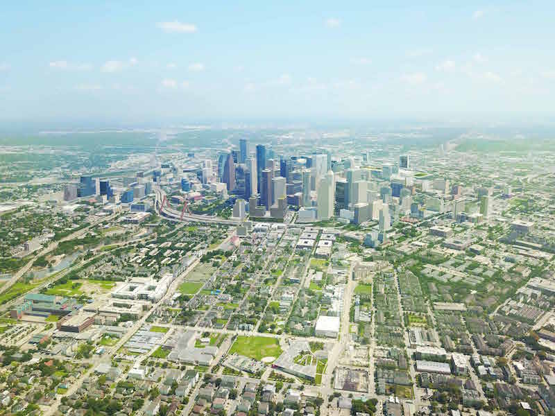
On August 30, 2036, Houston will celebrate its Bicentennial. In preparation for that occasion, city leaders have devised an ambitious plan to make its Downtown the center of its universe, and the focal point of its activities and growth.
The 48-page “Plan Downtown: Converging Culture, Lifestyle & Commerce,” is the product of an 18-month process led by several downtown partner organizations and city, county, and community leaders. It also incorporates “robust” public input. The plan considers nearly 150 recommendations that range from big-picture ideas to small, localized upgrades.
The plan was spearheaded by Asakura Robinson, a planning, urban design and landscape architecture firm, working with AEC consultants Sasaki, Traffic Engineers Inc., and HR&A Advisors. The consultants also tapped a 166-member steering committee of elected officials, community leaders and area residents.
Funding for researching and writing this plan came from the Downtown District, Downtown Redevelopment Authority/TIRZ No. 3, and Houston First Corporation.
It’s not like Houston has been standing still. Since 2004, nearly $6 billion has been invested across a broad range of urban uses that include offices, residences, and parks. Today, more than $1.39 billion in new Downtown construction projects are underway, and another $2.58 billion are in preconstruction or design. An additional 2.86 million sf of office space is being built, as well as eight hotel high rises.
The goal of the new plan is to accentuate Downtown’s “interconnectedness” with this sprawling city, Harris County, and neighboring counties.
At the heart of downtown is the George R. Brown Convention Center, which under this new plan would be upgraded and expanded to include a new South Expo Hall. The construction of two new large hotels near the convention center are also envisioned, along with a “dynamic, elevated pedestrian connection” from the convention center to the eastern sector of downtown.
In East Downtown, the plan calls for adding 4,000 hotel rooms, with the 20-year goal of 12,000 hotel rooms throughout the Downtown area, including no fewer than 8,000 located within a 10-minute walk from the convention center.
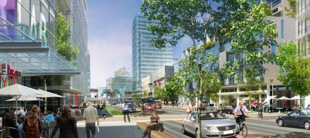
Enhancing and expanding Downtown’s activity centers and attractions would also create within Houston’s Theater District “an immersive arts and culture environment.” Housing and mass transit would be expanded in different Downtown quadrants, as would pedestrian and bike trails, and public spaces.
That effort would include the development of a five-mile-long Downtown Green Loop as part of the city’s 24-mile, $7 billion, decade-long infrastructure project that entails a full rebuild of three highways encircling Downtown. The Green Loop would interact with the city’s bayou system and its street grid.
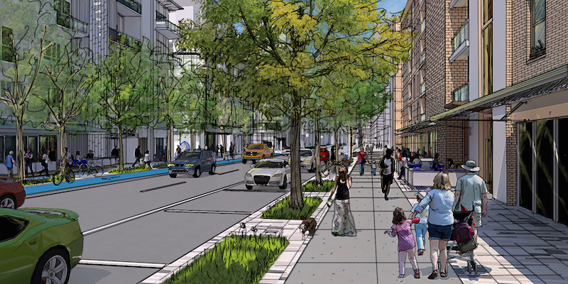
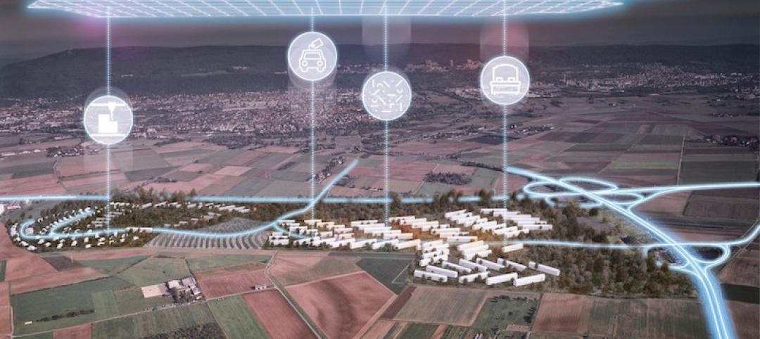
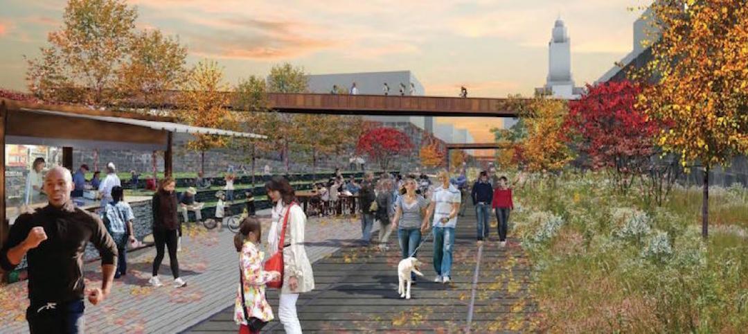
Walkability is a big factor in the redevelopment plan for Downtown Houston, which also calls for a proactive shift toward the support of autonomous vehicles and ride sharing. Image: Courtesy Houston Downtown Management District.
Other highlights of this plan include:
•Working with existing property owners and managers to convert 5% to 10% of Downtown properties into new office spaces for start-up and small businesses at affordable and/or protected rents.
•Creating a Downtown innovation district. (Today, there are more than 250 early-stage software and digital technology companies operating in the Downtown area.)
•Building 12,000 residential units within Downtown to support its projected population growth to 30,000 (from 7,500 today) over the next 20 years. The plan calls for building a public elementary school and public middle school within two or more of the Downtown residential neighborhoods.
•In Downtown’s western quadrant, redeveloping the currently vacant Barbara Jordan Post Office, which takes up eight blocks, into a “one-of-a-kind” multicultural center with food, art, retail, offices, hospitality, educational facilities.
•Becoming a national leader for connectivity innovation. The city would adapt autonomous vehicle technologies by managing Downtown parking with future decreases in demand while adapting new street, garage, and curb space use that include supporting autonomous vehicles with service zones, changing stations, and dedicated transit lanes.

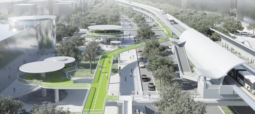
A perspective from Downtown Houston's North Canal, which under the new plan would, among other things, expand student housing for the University of Houston, connect Buffalo Bayou with Allen's Landing, add a North Downtown Transit Center, and establish enhanced stormwater retention centers. Image: Courtesy of Houston Downtown Management District.
This connectivity initiative would ensure the integrity of Downtown’s power grid, expand WiFi service in parks and public spaces, expand shared mobility, and use smart street light systems to collect and disseminate data on traffic, noise, air quality and so forth.
Houston is still drying out from the dunking it received from Hurricane Harvey. But surprisingly little detail is provided in the plan about how the development of Houston’s downtown would contribute to future storm protection and recovery. There are general references, such as the call for civic spaces—libraries, schools, community centers—that front the Green Loop to support resilience and disaster recovery goals. But few specifics; in fact, the word “resilience” appears only seven times in the plan’s text.
Related Stories

Urban Planning | Apr 3, 2017
Capturing the waterfront draw
People seem to experience a gravitation toward the water’s edge acutely and we traverse concrete and asphalt just to gaze out over an open expanse or to dip our toes in the blue stuff.
Urban Planning | Mar 31, 2017
4 important things to consider when designing streets for people, not just cars
For the most part what you see is streets that have been designed with the car in mind—at a large scale for a fast speed.
Urban Planning | Mar 14, 2017
Denmark-based architecture firm gives China the world’s longest elevated bike path
The Xiamen Bicycle Skyway stretches for 7.6 kilometers throughout the central part of the city.
Urban Planning | Feb 9, 2017
Abandoned WWII-era military village to become 'commune for the 21st century'
The village in Heidelberg, Germany, which 16,000 Americans called home at one time, is being redesigned as a commune for up to 4,000 people.
Green | Feb 6, 2017
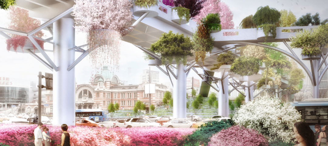
A to Z: Seoul’s elevated park features 24,000 alphabetized plants
The plants will represent 250 species found in South Korea.
Urban Planning | Jan 17, 2017
Using 'hidden data' to probe urban problems
The Center for Neighborhood Technology has been tackling poverty, housing, transportation, and environmental issues for four decades.
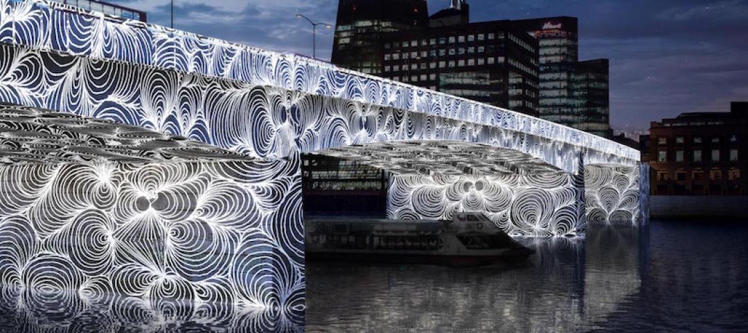
Architects | Nov 11, 2016
Six finalists selected for London’s Illuminated River competition
The competition is searching for the best design for lighting the bridges of central London.

Building Tech | Nov 9, 2016
Dubai to Abu Dhabi in 12 minutes: A hyperloop from Hyperloop One and BIG could make it possible
The pods can reach speeds of up to 1,100 kilometers per hour.
Urban Planning | Nov 4, 2016
Rail Park breaks ground in Philadelphia
The project is finally moving forward after nine years in the making.
Urban Planning | Oct 27, 2016
Paris plans to transform the right bank of the river Seine into car-free pedestrian zone
Drivers are worried the move will cause an increase in traffic congestion.


