


When it comes to the locals and visitors of the world’s major cities, a cellular phone is a staple. With that many people using their phones, a lot of interesting patterns can be observed from analyzing their data and phone usage information.
This is what developers at MIT’s SENSEable City Laboratory created together with Ericsson: ManyCities, a new website that “explores the spatio-temporal patterns of mobile phone activity,” ArchDaily reports. The web tool takes complex data and organizes it so that users can easily visualize the patterns of human movement within the city.
A chat board on the right-hand side allows users to post their observations, creating a forum where urban planners, demographers, and anyone else interested can cross-pollinate and find creative ways of using the data.
So far, the cities available on the web tool are London, New York, Hong Kong, and Los Angeles.
Related Stories
| Sep 12, 2011
Geist opens European branch
The new branch provides the company’s international clients with additional support and services.

| Jul 21, 2011
Bringing BIM to the field
A new tablet device for construction professionals puts 3D data at the fingertips of project managers and construction supervisors.

| May 18, 2011
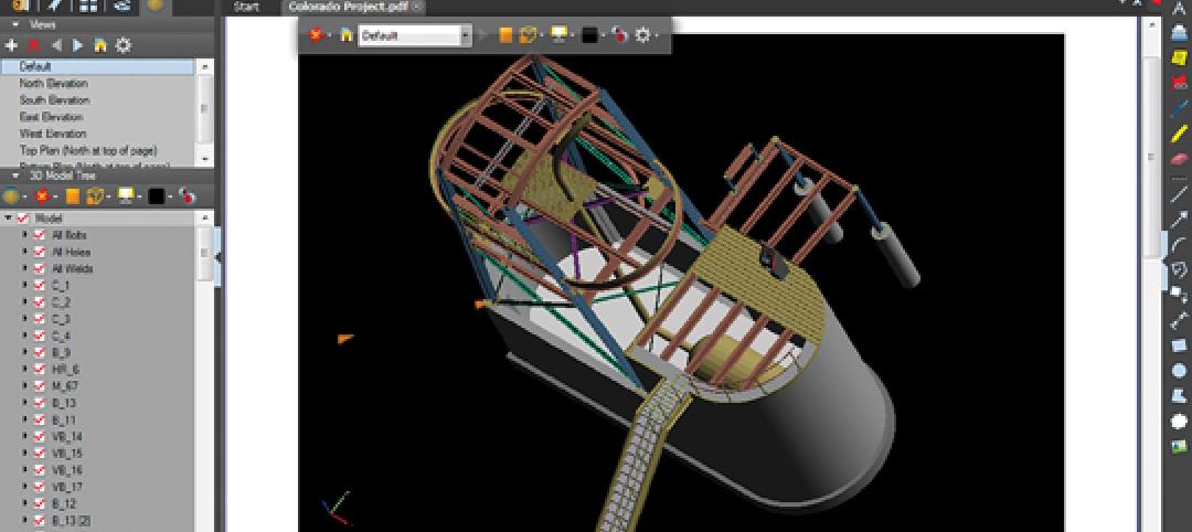
New Tool Takes PDFs Beyond 2D
Our IT expert puts a new PDF creation package through its paces and sees value for AEC firms that want to move more aggressively into 3D documents.


