

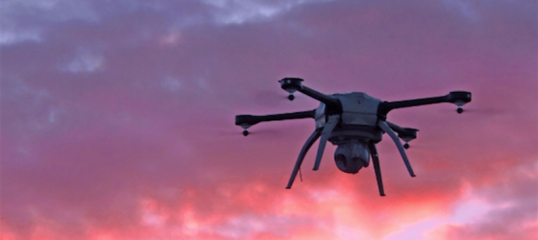
Drone maker 3DRobotics (3DR) has teamed with Autodesk and Sony to launch Site Scan, an aerial analytics platform for use by field professionals to inspect, survey, and scan jobsites and land masses, and deliver image-capture data via the cloud for quicker processing and 3D modeling.
Keith Bigelow, a VP at 3DR’s Enterprise division, tells BD+C that for the past year his company has worked with the reality-capture team at Autodesk to understand how a product like Site Scan would need to perform in order produce high-resolution images that could be processed by modeling tools “that AEC customers are using every day.”
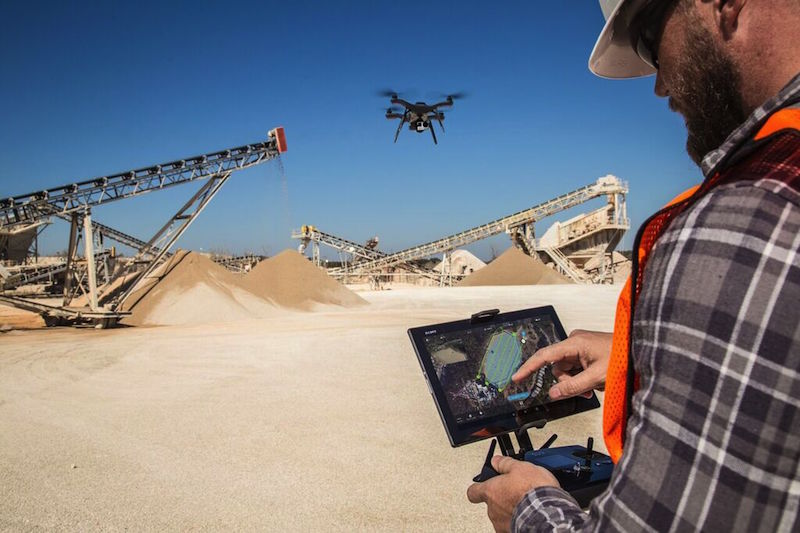
The resulting package includes a Solo drone that can be programmed to fly over a designated area without pilot assistance; a Sony Xperia Z4 tablet with a pre-installed Site Scan software; a Sony UMC-R10C or GoPro Hero4 Black camera equipped with lenses for inspection and 2D and 3D mapping; unlimited storage in 3DR’s cloud; and unlimited processing and publishing credits with Autodesk’s cloud, known as FORGE.
The drone’s flight time is about 20 minutes per battery, and is best suited for inspecting and scanning sites that are between two and 160 acres, says Bigelow.
A tablet with the Site Scan app can be used to manage the flight and image collection. (The tablet also runs Google Earth, which is used to program the drone’s flight path.)
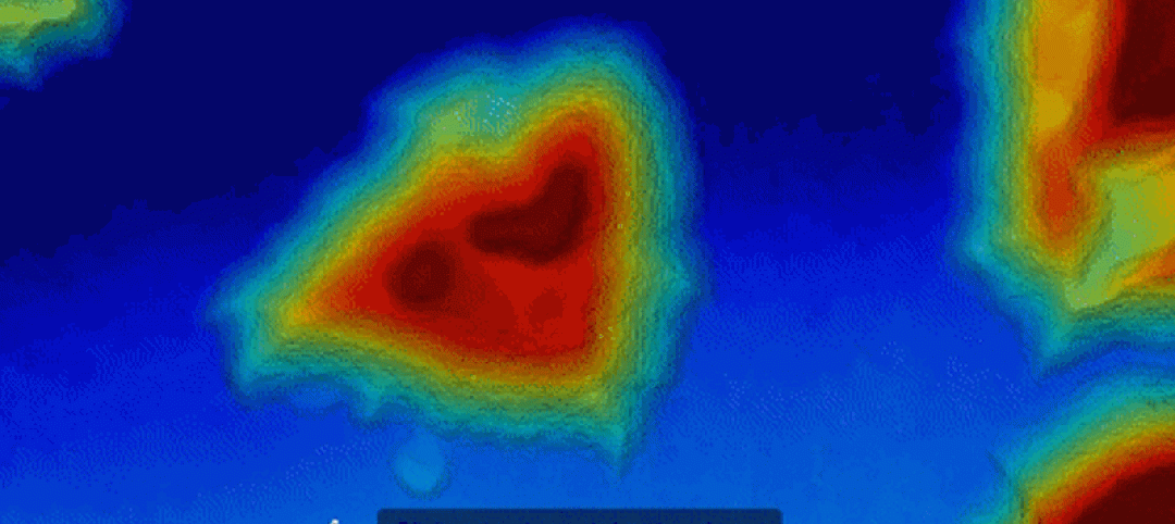
Site Scan’s Survey mode captures and creates high-resolution maps and digital elevation models, while its Scan mode captures and creates 3D models. These reality data—such as 3D point cloud, 2D orthographic views, and 3D mesh—can be integrated into popular professional design and engineering platforms, including many of Autodesk’s products.
3DR is an early adopter of the FORGE platform, leveraging the ReCap Photo Web API. “Capture technology is rapidly transforming the way people collect information and make insightful decisions in the field,” says Amar Hanspal, SVP of Products at Autodesk.
The Site Scan package, which includes four batteries and a charger, will be available in June for $4,999, plus a monthly service fee of $499 that covers the drone and tablet license, cloud access, and technical support.
Bigelow says AEC firms are Site Scan’s primary targets, and he foresees this platform being helpful to inform design and construction decisions for a host of different building projects.
He also points out Site Scan will be available around the time that the Federal Aviation Administration issues its new rules for commercial drone use, which are expected to allow a person to fly a drone without a pilot’s license as long as he or she is certified by passing a written test that demonstrates familiarity with FAA’s UAV education booklet.
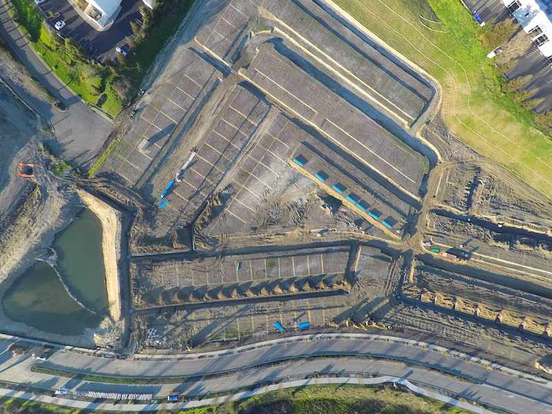 A high-resolution image of a construction site, captured by a camera-equipped drone that is part of the Site Scan platform. Image: 3DRobotics
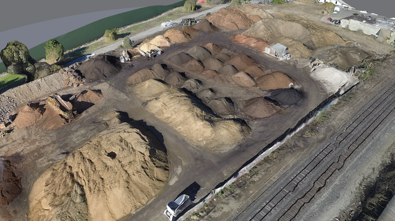 A 3D model of a land site created from point-cloud data processed through Site Scan's software. Image: 3DRobotics
Related Stories

Drones | Dec 7, 2016
Could this idea for an Urban Droneport facilitate the future of drone-based deliveries?
The project was designed by Saúl Ajuria Fernández as part of his master’s degree in architecture.
Sponsored | Drones | Oct 25, 2016
FAA issues rules for commercial drone use
People in the construction business are finding all sorts of great applications for drones, including the inspection of remote locations, getting a high viewing angle for monitoring construction progress, or showing off an impressive aerial view of a finished project.

Drones | Jul 13, 2016
FAA issues final rule on commercial use of drones
The rule covers commercial uses for drones that weigh less than 55 pounds, and it takes effect Aug. 29.
Drones | Apr 25, 2016
The Tremco SkyBEAM UAV is the first to be approved by the FAA for nighttime commercial operation
The SkyBEAM UAV is used for identifying energy leaks, rooftop damage, deteriorating façades, and safety issues without requiring scaffolding or cranes.

Drones | Mar 18, 2016
Drones aren't just a curiosity anymore for AEC firms
UAVs, now mounted with higher-quality image-capture cameras and software, offer crisp building and site inspections.
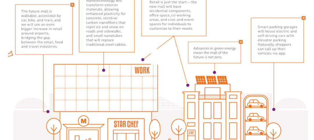
Retail Centers | Mar 16, 2016
Food and technology will help tomorrow’s malls survive, says CallisonRTKL
CallisonRTKL foresees future retail centers as hubs with live/work/play components.
Drones | Feb 3, 2016
A new volume measurement tool makes drone imagery easier to analyze
DroneDeploy’s latest app is available for all mobile devices.


