

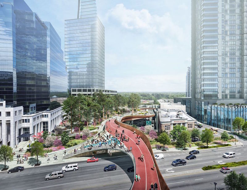
Early next month, the Buckhead Community Improvement District (BCID) is scheduled to meet about how to move forward with its plan for a half-mile-long urban park that would be built over a busy highway and MARTA rail line that currently bifurcate this affluent Atlanta neighborhood.
BCID, a group of businesses that tax themselves for infrastructure projects, unveiled the initial design concept for Buckhead Park Over GA400 (for Georgia State Route 400) at the Buckhead Theater on September 7. The overhead park would stretch 2,400 feet from the Atlanta Financial District on Peachtree Road to the Lenox Road-GA 400 interchange. It would also connect with the PATH 400, a regional recreational and commuter bike path and running trail.
Another group, called Central Atlanta Progress, last month proposed a similar, more ambitious deck proposal that would cap the city’s Downtown Connector—known as “The Stitch”—from Spring Street to an area near Georgia Power’s headquarters, according to the Atlanta Journal-Constitution.
While a recent poll found strong support for the bigger project, it would cost an estimated $300 million, whereas backers of Buckhead Park Over GA400 have pegged the price tag for realizing their concept at a bit above $150 million.
Buckhead Park Over GA400, which was designed by Rogers Partners Architects + Urban Designers with Nelson Byrd Woltz Landscape Architects, would have three components:
•The Commons, at the north end of the park, would include an intimate amphitheater for formal and casual gatherings.
•The Plaza, at the midpoint of the park, would provide access to surrounding retail, restaurants, and the rail line.
•The Gardens, as its name implies, would be dominated by a garden setting, and provide a green oasis for visitors. The park itself would be unified by shade trees that run the length of the concept.
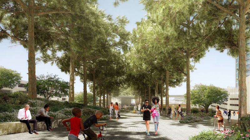
An allee of shade trees would run the length of the park, whose southern end would offer a garden setting. Image: Rogers Partners Architects + Urban Designers/Nelson Byrd Woltz Landscape Architects.
Buckhead Park would have extensive pedestrian paths that connect to surrounding streets, encouraging people to use it as a thoroughfare to reach workplaces, their homes, or cultural attractions.
“This park will create quality public space where you already have density,” explained Rob Rogers, principal at Rogers Partners. “Like most great public places, it’s about creating a series of scaled experiences for visitors.”
Buckhead Park would be the latest in a series of elevated urban parks that have made their marks in cities such as New York, Paris, and Dallas. BCID is positioning Buckhead Park not only as a counterbalance to Atlanta’s car-heavy culture, but also as a potential boon to local businesses for which the park would generate more foot traffic.
“We are very excited to move ahead on this pioneering project,” says Jim Durrett, BCID’s Executive Director. “When Buckhead Park Over GA400 is complete, Atlanta will have a unique, world-class civic space that is both beautiful and functional.”
Before it meets next month, BCID will review community feedback about the project. Its next stage would be preliminary engineering, engaging key agency partners, and coming up with a funding strategy.
Related Stories

Urban Planning | Dec 5, 2017
A call for urban intensification
Rather than focus on urban “densification" perhaps we should consider urban “intensification.”
Urban Planning | Dec 4, 2017
Sports ‘districts’ are popping up all over America
In downtown Minneapolis, the city’s decision about where to build the new U.S. Bank Stadium coincided with an adjacent five-block redevelopment project.
Urban Planning | Dec 4, 2017
Can you spark an urban renaissance?
Thoughtful design, architecture, and planning can accelerate and even create an urban renaissance.
Urban Planning | Nov 20, 2017
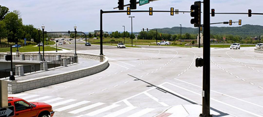
Creating safer streets: Solutions for high-crash locations
While there has been an emphasis on improving safety along corridors, it is equally important to focus on identifying potential safety issues at intersections.
Urban Planning | Nov 16, 2017
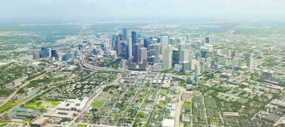
Business groups present a new vision of Downtown Houston as that city’s unavoidable hub
The plan, which took 18 months to complete, emphasizes the centrality of downtown to the metro’s eight counties.

Architects | Oct 30, 2017
City 2050: What will your city look like in 2050?
What do we think the future will look like 30 years or so from now? And what will City: 2050 be like?
Great Solutions | Oct 17, 2017
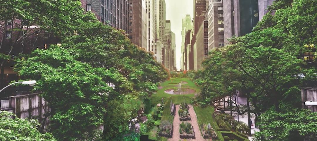
Loop NYC would reclaim 24 miles of park space from Manhattan’s street grid
A new proposal leverages driverless cars to free up almost all of Manhattan’s Park Avenue and Broadway for pedestrian paths.
Mixed-Use | Aug 2, 2017
Redevelopment of Newark’s Bears Stadium site receives team of architects
Lotus Equity Group selected Michael Green Architecture, TEN Aquitectos, Practice for Architecture and Urbanism, and Minno & Wasko Architects and Planners to work on the project.
Urban Planning | Jul 21, 2017
Streets as storytellers: Defining places and connecting people
“In a city the street must be supreme. It is the first institution of the city. The street is a room by agreement, a community room, the walls of which belong to the donors, dedicated to the city for common use.” – Louis Kahn
Urban Planning | Jun 26, 2017
Convenience and community lead the suburban shift
As the demand for well-connected urban locales increases, so too has the cost of property and monthly rent; and as suburbs typically offer a bargain on both, more people are looking for a compromise.


