


Scott Bernstein owes his start as a game changer to a dog bite. Actually, quite a few dog bites. Not one of which was inflicted on his own person.
The year was 1974. Bernstein, then a Research Associate at Northwestern University’s Center for Urban Affairs, was asked a “deceptively simple question”: How do you make people healthier? The request came from the Christian Action Ministry (now Bethel New Life), a consortium of churches on Chicago’s West Side.
Ministry leaders were frustrated. The medical clinics they operated were doing an exemplary job. But church leaders wanted to get a better grip on why so many neighborhood people were getting sick and injured.
Bernstein, who earned a BS in political science from Northwestern, was undaunted by his lack of medical training. He assembled a team of graduate students and marched them off to the emergency rooms of local hospitals. “You can learn a lot from an emergency room,” he says.
The team gathered 22,000 print records of trauma cases and “translated” them from doctor-speak into plain English. “The record might have said ‘fractured tibia,’ but when you dug into the paperwork, it really showed ‘car-to-bicycle collision at twilight, rain, nonfunctioning stoplight, driver stoned,’” he says. Doc-speak just didn't tell the real story.
Ten conditions rose to the top, among them respiratory infections and injuries from personal attacks. “We’d go to neighborhood meetings and ask, What’s your biggest health problem?” says Bernstein. “People would say, Oh, juvenile diabetes, and we’d say, Sorry, not on the list.”
Number 10 on the list: dog bites. “Everyone had a story about dog bites,” he recalls with amusement. But nobody knew where the canine culprits were hiding. He and his “health detectives” got on the case.
They invented a cheap lanyard and hired local boys to catch the strays and bring them to a specified location every day. There, the boys would point on a map exactly where they had caught the dogs.
The maps quickly revealed that the dogs were congregating in specific garbage-strewn alleys and abandoned buildings. “The community organized, we got a small grant to clean things up, and for a few thousand dollars the dog-bite problem pretty much disappeared,” says Bernstein.
For the next three years, Bernstein probed questions posed by the ministry: Why were so many pedestrians being injured by automobiles? After mapping accident data, the health detectives found that cars were spilling over from expressways into poorly lighted side streets during rush hour, hitting children and adults who were coming home from school and work.
Armed with the data, the community got improved lighting and changed street patterns to slow down drivers. Car-to-people injuries declined.
Another major medical concern: poor nutrition. With the departure of a dozen supermarkets, the West Side had become an early case study of a food desert. Bernstein worked with the ministry to build greenhouses to grow fresh vegetables, but the experiment eventually failed.
In mid-1977, Bernstein, faced with uncertainty about his funding from Northwestern, got a sympathetic but firm ultimatum from his wife of three years. “She gave me a month to solve our ‘personal income stream problem,’” he recalls.
Bernstein and a colleague, Kathy Tholin, started scrambling for grants. By August 24, they had put together enough funding to co-found the Center for Neighborhood Technology.
PARKING: HOW MUCH IS TOO MUCH?
CNT’s 30 full-time staff members concentrate on four interrelated urban-related problems: sustainability/climate change; transportation/transit-oriented development (TOD); water/stormwater; and housing affordability.
The work often follows the “dog bite” methodology: Take on a seemingly confounding urban question. Find the “hidden data” that gets to the real source of the problem. Map the findings. Analyze the results. Propose solutions. CNT’s newest twist: Create an online tool that helps others address the problem.
A few years ago, officials in King County, Wash., asked CNT to review its parking requirements for apartment buildings. Peter Haas, PhD, a former Fermilab astrophysicist and CNT's Chief Research Scientist for the past 14 years, developed a model that correlated parking spaces to population, job density, unit size, and distance from transit. At the county’s suggestion, CNT hired researchers to go into more than 100 apartment building garages—at the ungodly hour of 3:00 a.m.—and count spaces.
To everyone’s amazement they found that 35% of parking spaces were empty. CNT argued that, at a cost of up to $37,500/space to build structured parking, requiring fewer spaces was a carrot that King County (and other jurisdictions) could dangle in developers’ faces to encourage them to build additional affordable rental units.
CNT conducted a similar experiment for the District of Columbia, with virtually the same results. Next came online “right-sizing” calculators for King County, the District of Columbia, and the Bay Area of San Francisco. The tools help community groups, developers, zoning officials, and planners evaluate the real demand for parking in multifamily developments.
To my mind, CNT’s work on housing affordability and “location efficiency” is its crowning achievement. The traditional view is that housing should cost no more than 30% of family income. By that measure, 55% of U.S. neighborhoods would be “affordable” to the typical U.S. family. But when you factor in transportation costs—not just for commuting, which accounts for just 18% of total transportation costs, but also for trips for shopping and medical appointments and soccer practice—only 26% of U.S. neighborhoods are affordable for most families.
One way to attack poverty, in CNT’s view, is to trim a family’s transportation costs by providing better access to jobs, shopping, and services. Those savings could give a low-income family 20% more disposable income, as CNT's “Housing + Transport Index” tool can show. Making home energy upgrades would add even more to the family's bottom line.
FOUR INITIATIVES IN THE WORKS
In August, Erin Grossi, PhD, was brought in to replace Kathy Tholin, who retired in June, as CEO. Grossi, the former Chief Economist at Underwriters Laboratories, will be developing an urban consulting practice to test startup technology projects with venture capitalists and other civic groups on transport, water/wastewater, energy, and the built environment.
CNT is no stranger to what is now termed “social entrepreneurship.” Fourteen years ago, it created I-Go, a pioneering car-share program, which it sold to Enterprise in 2013. It developed a soup-to-nuts program to help homeowners and businesses in poor neighborhoods make their buildings energy efficient. The program provided energy audits, financing, and qualified contractors to do the work. It was spun off and now operates as Elevate Energy.
Linda Young, a 16-year CNT veteran who heads its 10-member data group, will be focusing on evidence-based, science-backed data gathering and analysis. “We want to put the data into a format that people can use more readily,” she says.
One beneficiary of such an effort could be the real estate community. CNT’s GreenTRIP Connect provides an online tool for developers to plug in data about their projects to help determine the best locations for apartment buildings to optimize transit use by tenants. Right now, the tool only covers California. Young wants to make it applicable nationally.
A third initiative, “Rain Righting,” uses LIDAR (light detection and ranging) to help communities map areas where flooding is really a threat. (A CNT data mapping study showed that urban flooding was more closely related to the intensity of the built environment than whether the site was in a federally designated floodplain.) Communities can then use the data to install economical green solutions like bioswales and permeable paving to control flooding.
CNT’s big push, which Bernstein himself is leading, is its Urban Opportunity Agenda. CNT analyzed 10 of the nation’s most economically hard-hit communities and quantified a portfolio of strategies that could reduce poverty in each by 25%. Philadelphia alone could reduce poverty by $476 million a year through such strategies as mining its waste stream, creating food security jobs, and improving access to jobs.
CNT has suffered the occasional setback.
An initiative to reduce homeowner energy bills in Memphis, which has the highest home energy costs in the South (and a 27% poverty rate), died when the then-mayor, its chief supporter, lost a reelection bid.
Bernstein says his biggest regret is not focusing on the problem of food deserts on Chicago's West Side. “We should have helped in starting up food stores to compete in those neighborhoods,” he says.
CNT, which does half its work outside the immediate Chicago area, calls itself “an innovations laboratory for urban sustainability.” Bernstein jokes that he and his team are “strict integrationists” of ideas and technologies in the cause of equity and social justice. “Cities don’t work on transportation one year and energy conservation the next,” he says. “All those things have to come together.”
Related Stories
Multifamily Housing | Feb 21, 2023
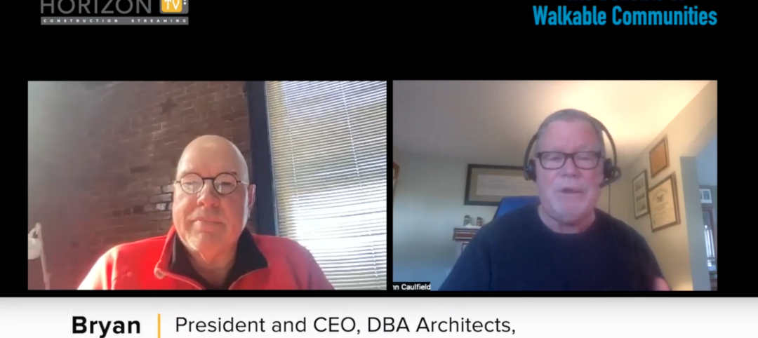
Watch: DBA Architects' Bryan Moore talks micro communities and the benefits of walkable neighborhoods
What is a micro-community? Where are they most prevalent? What’s the future for micro communities? These questions (and more) addressed by Bryan Moore, President and CEO of DBA Architects.

Augmented Reality | Jan 27, 2023
Enhancing our M.O.O.D. through augmented reality therapy rooms
Perkins Eastman’s M.O.O.D. Space aims to make mental healthcare more accessible—and mental health more achievable.

Urban Planning | Jan 18, 2023
David Adjaye unveils master plan for Cleveland’s Cuyahoga Riverfront
Real estate developer Bedrock and the city of Cleveland recently unveiled a comprehensive Cuyahoga Riverfront master plan that will transform the riverfront. The 15-to-20-year vision will redevelop Tower City Center, and prioritize accessibility, equity, sustainability, and resilience.

40 Under 40 | Oct 19, 2022
Meet the 40 Under 40 class of 2022
Each year, the editors of Building Design+Construction honor 40 architects engineers, contractors, and real estate developers as BD+C 40 Under 40 awards winners. These AEC professionals are recognized for their career achievements, passion for the AEC profession, involvement with AEC industry organizations, and service to their communities.

Urban Planning | Jul 28, 2022
A former military base becomes a substation with public amenities
On the site of a former military base in the Hunters Point neighborhood of San Francisco, a new three-story substation will house critical electrical infrastructure to replace an existing substation across the street.

Urban Planning | Jul 19, 2022
The EV charger station market is appealing to investors and developers, large and small
The latest entry, The StackCharge, is designed to make recharging time seem shorter.

Sustainable Development | Jul 14, 2022
Designing for climate change and inclusion, with CBT Architects' Kishore Varanasi and Devanshi Purohit
Climate change is having a dramatic impact on urban design, in terms of planning, materials, occupant use, location, and the long-term effect of buildings on the environment. Joining BD+C's John Caulfield to discuss this topic are two experts from the Boston-based CBT Architects: Kishore Varanasi, a Principal and director of urban design; and Devanshi Purohit, an Associate Principal.
Sponsored | Healthcare Facilities | May 3, 2022
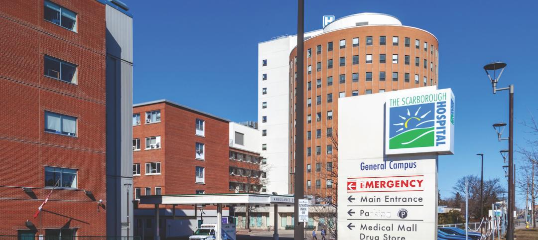
Planning for hospital campus access that works for people
This course defines the elements of hospital campus access that are essential to promoting the efficient, stress-free movement of patients, staff, family, and visitors. Campus access elements include signage and wayfinding, parking facilities, transportation demand management, shuttle buses, curb access, valet parking management, roadways, and pedestrian walkways.
Urban Planning | Apr 5, 2022
The art of master planning, with Mike Aziz of Cooper Robertson
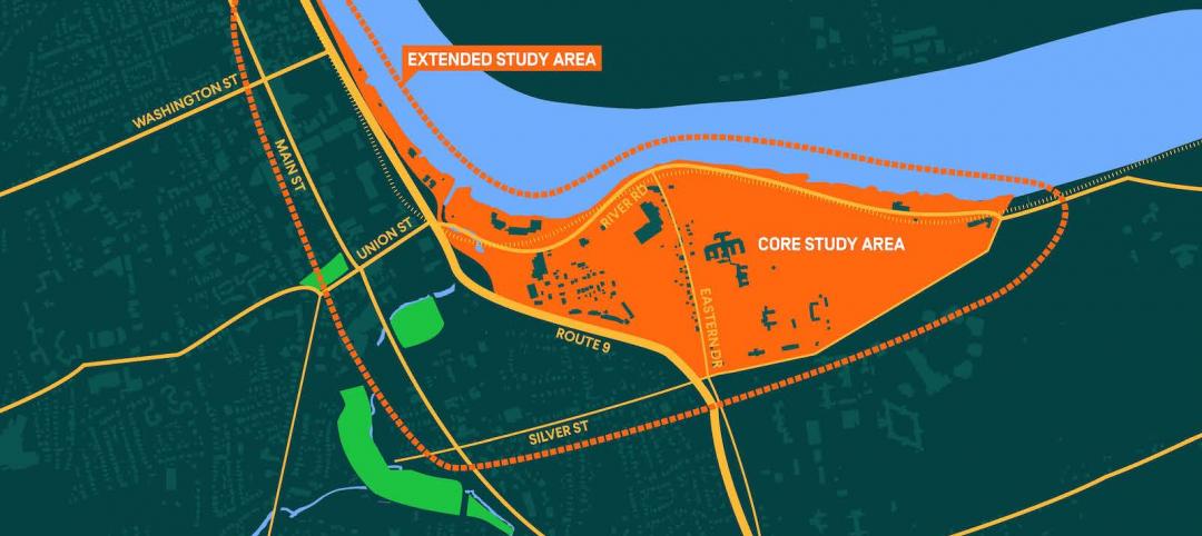
Mike Aziz, AIA, LEED AP, Partner and Director of Urban Design with Cooper Robertson, discusses his firm's design for the redevelopment of a Connecticut town's riverfront.

Multifamily Housing | Mar 29, 2022
Here’s why the U.S. needs more ‘TOD’ housing
Transit-oriented developments help address the housing affordability issue that many cities and suburbs are facing.


