

Documenting a construction site is a time-consuming process that can require equipment such as tripods and scanners, the need to hire outside experts to operate said equipment, or tasking an unlucky individual with the job of walking to various points throughout a jobsite and manually taking photographs and video.
But what if the process of jobsite documentation was completely passive, with processing times in the minutes instead of the hours or days needed by 3D capture or alternative 360-degree solutions? Thanks to OpenSpace’s AI-powered photo documentation solution, that “what if” has become a reality.
The idea behind OpenSpace’s technology is to create a Google “Street Views” for the jobsite. This passive experience is created by adapting Google’s method for capturing street view photos all across the world, except with a simple 360-degree camera (currently the Garmin VIRB 360 is supported) mounted atop a hardhat, in lieu of a Subaru Impreza.
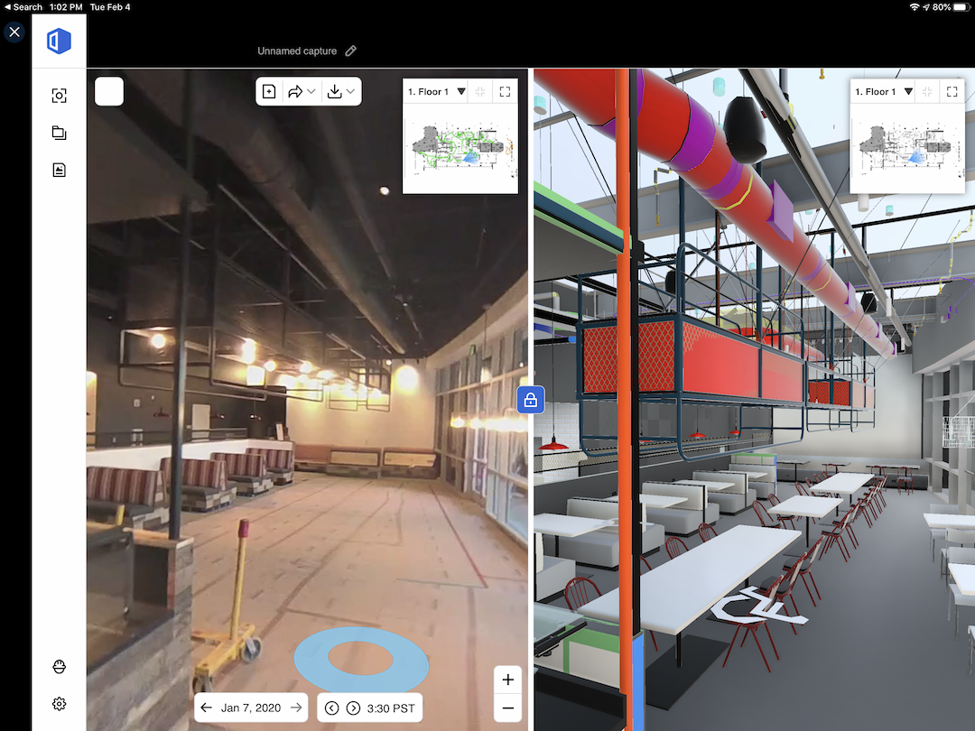
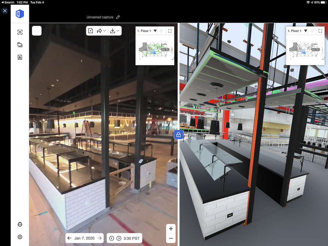
When going on a normal site walk, the user just needs to press record on the accompanying smartphone app and photos captured every half-second will be automatically tied to project plans. The walk track is automatically computed and photos are aligned, stitched together, and mapped to the floor plans.
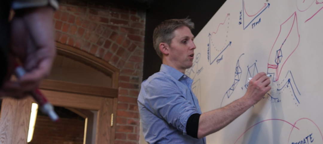
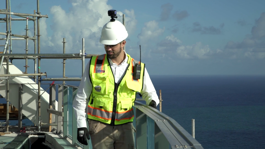 With a Garmin VIRB 360 camera mounted to a hard hat, OpenSpace allows for an entirely passive documentation process. Photo: OpenSpace.
“The passive nature of the documentation process is extremely valuable because it gives me the ability to focus on other things,” says Andy Dalbom, Construction Superintendent with McCownGordon Construction, based in Kansas City, Mo. “I use the walk to give me time to dig into the details of the building, checking quality, assuring safe work practices, and even carry on phone conversations.”
The heart of this jobsite capture and mapping is OpenSpace’s Vision Engine, an AI system that combines computer vision, 3D reconstruction, and big data visualization. The Vision Engine learns, so the more a user walks a jobsite, the faster the results will be generated. OpenSpace claims after just a few walks, most projects will get results within 15 minutes.
OpenSpace is also integrated with products like Procore, PlanGrid, and BIM360. Users can use a side-by-side cloud-based BIM Viewer to compare the actual conditions and process of a jobsite against the model, all in the browser, with features such as the ability to turn layers on and off, and take snap measurements.
Real results on real projects
Level 10 Construction, a Sunnyvale, Calif.-based general contractor, is using OpenSpace’s site documentation technology on select projects, including 3045 Park Boulevard in Palo Alto. The 31,000-sf R&D building sits on a 1.3-acre site.
While 1.3 acres is not as large as many construction sites, it can still be a chore to walk around taking pictures manually or use other documentation methods that require things like tripods, scanners, or outside experts. Chores take time, and time costs money. For Level 10 Construction, this is where OpenSpace made its benefits known.
“The rate of capture is much quicker than other solutions that require you to take photos in various locations versus just walking the project site,” says Jacob Freitas, Senior Project Manager with Level 10.
When taking pictures for site documentation manually, Freitas would only take a picture every 30 feet or so. But because OpenSpace captures an image every half-second, the documentation is not only easier, but much more detailed. And you never know when detailed site documentation will come in handy.
See Also: These 17 women are changing the face of construction
Case in point: When a metal panel was damaged on the 3045 Park Boulevard project, the team responsible for installing the panels blamed the team responsible for scaffolding. The OpenSpace documentation was reviewed, and being able to go back to specific points in time on specific dates allowed Freitas and his team to immediately establish that the damage had taken place before the scaffold had gone up, exonerating the scaffolding team.
McCownGordon tested OpenSpace’s passive site documentation on its Patterson Health Center project in Anthony, Kan. “We used the technology to record all above-ceiling and in-wall rough-in throughout the building for the end user,” says Dalbom. “This gave them the ability to see inside the walls, above the ceilings, and around structures that would not be as detailed with standard photos.”
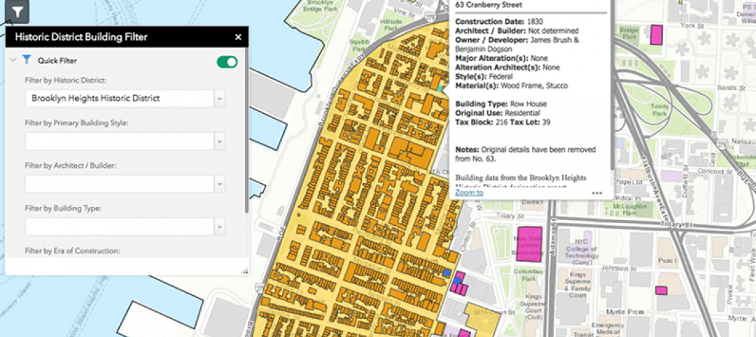
 Images can quickly be pinpointed to a certain date or time to check progress and stay on schedule. Image: Level 10 Construction.
Because the system didn’t require spending days with a tripod, recording only once per phase of the project, the team was able to do numerous “OpenSpace Walks,” as Dalbom refers to them, which resulted in a more complete product to turn over to the facilities staff at the end of the project.
The images captured during walks are coordinated with the floor plan of the building, so, according to Dalbom, it is easy to find the photos that reference an exact area the user is looking at. “During construction, we were able to locate several items that were installed during rough in but covered by drywall. With the photographic information, we knew exactly where to cut out the drywall,” says Dalbom.
Level 10’s Freitas offers his takeaways from using OpenSpace on several projects:
• Reduction in time spent on capturing site documentation
• The production of detailed site progress documentation
• The ability to show the project owner progress during OAC meetings
• The ability to display existing conditions after demolition to inform the MEP design-build team during coordination
• Simplified RFI and submittal coordination.
For Dalbom and McCownGordon, the results were all about time savings, which translate to financial savings.
“When staff are not stuck running cameras for days at a time,” says Dalbom, “they are open to focus on their responsibilities of the project, helping everything run more smoothly.”
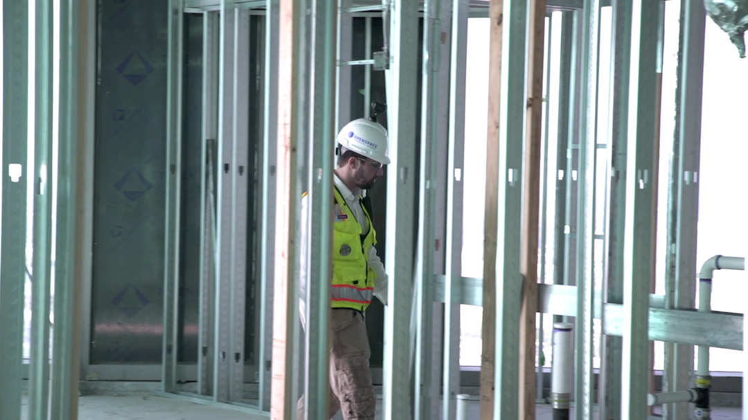 Photo: OpenSpace.
Related Stories
AEC Tech | Mar 7, 2018
Interoperability for the building industry – More wicked problems
This article is a follow up to Nathan Miller's 2016 article “The Wicked Problem of Interoperability”.

AEC Tech | Feb 28, 2018
Nine tips to bridge the cybernetic design gap
Unlike other technologies we have seen, augmented and virtual reality are looking to have staying power in a truly disruptive way.

AEC Tech | Jan 29, 2018
thyssenkrupp tests self-driving robot for ‘last mile’ delivery of elevator parts
“With driverless delivery robots, we could fill a gap and get spare parts from our warehouses to the jobsite faster,” said thyssenkrupp SVP Ivo Siebers.

AEC Tech | Jan 25, 2018
Four high-tech solutions to mitigate theft on the jobsite
Geo-fencing and drone surveillance are among the tech solutions for protecting jobsites from asset loss.

BD+C University Course | Jan 2, 2018
The art and science of rendering: Visualization that sells architecture [AIA course]
3D artist Ramy Hanna offers guidelines and tricks-of-the-trade to ensure that project artwork is a stunning depiction of the unbuilt space.
Reconstruction & Renovation | Dec 21, 2017
Interactive map includes detailed information on historic New York City buildings
The New York City Landmarks Preservation Commission launched a new, enhanced version of its interactive map, Discover NYC Landmarks.

AEC Tech | Dec 20, 2017
6 CFD post-processing tips to improve visualization productivity and quality
Southland Engineering’s Abdullah Karimi offers helpful tips for making computational fluid dynamics (CFD) models more productive.

Sponsored | Building Team | Nov 3, 2017
4 strategies for marketing your AEC firm
Having a clearly defined competitive brand and a fine-tuned marketing approach can give your firm a significant competitive advantage.

Sponsored | AEC Tech | Oct 19, 2017
3 reasons why your firm needs cloud software
For firms looking to propel their architectural design services to new heights and levels of sophistication, a consolidated cloud-based platform is a valuable asset.

AEC Tech | Oct 6, 2017
How professional bias can sabotage industry transformation
Professional bias can take the form of change-resistant thinking that can keep transformational or innovative ambitions at bay. Tech consultant Nate Miller presents three kinds of bias that often emerge when a professional is confronted with new technology.


